
Vintage City Maps
Picture this: stumbling upon your own neighbourhood on a map crafted centuries ago.
Explore our Vintage City Maps collection—a journey into the past that lets you rediscover your favourite destinations across the globe.
Unlike today's digitally saturated city maps, this collection stands apart. These are authentic pieces, sourced from historical archives and books, predating the era of GIS mapping and satellite images. They are a testament to craftsmanship in a time long before our modern technological advances.
Some pieces, we have given a light digital restoration to mend the wear and tear of centuries. Other pieces remain untouched, wearing their imperfections as an integral part of their story.
Our goal is simple: to honour the skill and dedication poured into these maps—each one a piece of art in its own right.


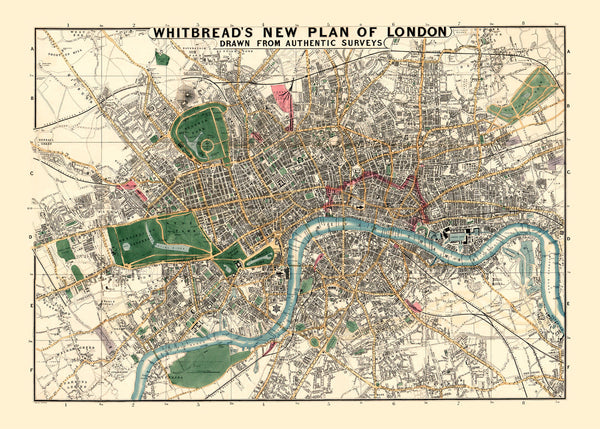
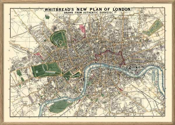
Map of London


Map of Copenhagen #2 1888


Vintage Map of Sejrø, Denmark


Vintage Map of Læsø, Denmark


Vintage Map of Fur, Denmark


Vintage Map of Femø, Denmark


Vintage Map of Endelave, Denmark


Vintage Map of Avernakø, Denmark


Vintage City Map of Marstal, Denmark


Vintage City Map of Marstal, Denmark


Vintage City Map of Nexø, Bornholm


Vintage Map of Køge & Køge Bay


Vintage parish map of Hørsholm


Vintage City Map of Holbæk, Denmark


Vintage City Map of Viborg, Denmark


Vintage City Map of Vejle, Denmark


Vintage city map of Ribe, Denmark


Vintage City Map of Randers, Denmark


Vintage City Map of Kolding, Denmark


Vintage City Map of Horsens, Denmark


Vintage City Map of Esbjerg, Denmark


Vintage City Map of Aarhus, Denmark


Vintage City Map of Aalborg, Denmark


Vintage City map of Odense & suburbs


Vintage City Map of Odense, Denmark


Vintage City Map of Nyborg, Denmark


Vintage City Map of Faaborg


Vintage Nautical Map of Scandinavia


Map of Copenhagen, 1888


Vintage Tourist Map of Tokyo


Vintage City Map of Kyoto


Ancient Kyoto City Map


